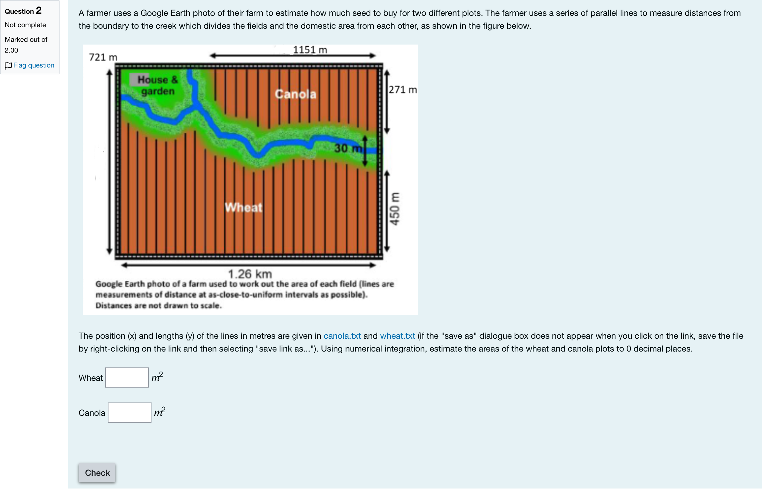
Question textA farmer uses a Google Earth photo of their farm to estimate how much seed to buy for two different plots. The farmer uses a series of parallel lines to measure distances from the boundary to the creek which divides the fields and the domestic area from each other, as shown in the figure below.The position (x) and lengths (y) of the lines in metres are given in canola.txt and wheat.txt (if the "save as" dialogue box does not appear when you click on the link, save the file by right-clicking on the link and then selecting "save link as..."). Using numerical integration, estimate the areas of the wheat and canola plots to 0 decimal places. Wheat Answer 1 Question 2[input] [math: m2]Canola Answer 2 Question 2[input] [math: m2]Check Question 2Multiple fill-in-the-blank
Log in for full answers
We've collected over 50,000 authentic original questions and detailed explanations from around the globe. Log in now and get instant access to the answers!
Similar Questions
Which is the highest polynomial order that allows the Simpson's 1/3 rule to obtain an exact value for integration?
Which of the following statements is true regarding the number of segments required for the Simpson’s 1/3 rule?
What is the approximate value of the following integral using two applications of the composite trapezoidal method? [math: f(x)∫−4.54(x3cos(x))dx]
Which is the highest polynomial order that allows the trapezoidal rule to obtain an exact value for integration?
More Practical Tools for Students Powered by AI Study Helper
Making Your Study Simpler
Join us and instantly unlock extensive past papers & exclusive solutions to get a head start on your studies!